Property Record
Newton Bridge Rd, Athens, GA 30607
NEARBY LISTINGS FOR SALE OR LEASE
Property Detail
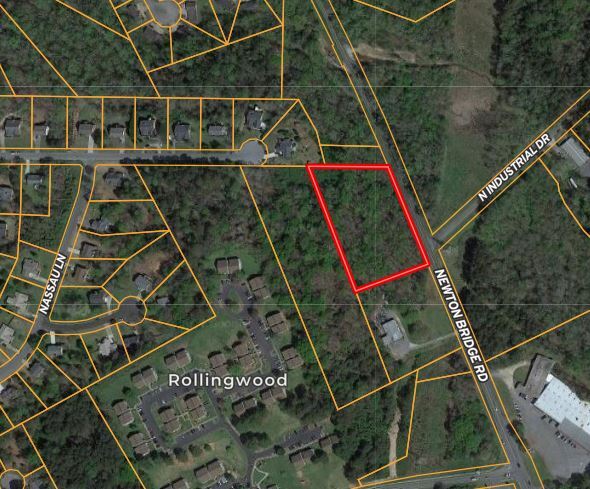
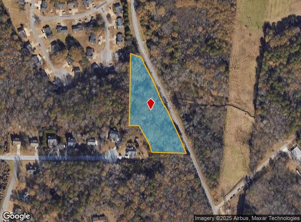
Newton Bridge Rd
Athens-Clarke County, GA
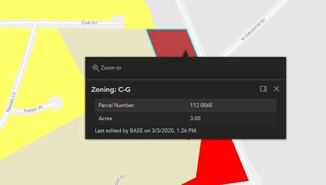
Com-St-034->00-03
112-006-F
TRACT B - 3.016 AC
Commercialacreage
Clarke
X
Georgia
13059C0015E
3.02 AC
2025
North Athens
2025
Other Market Areas
010602
DEMOGRAPHICS near Newton Bridge Rd
1 Mile
3 Mile
5 Mile
2024 Total Population
2,790
36,378
90,101
2029 Population
2,779
36,461
90,984
Pop Growth 2024-2029
(0.39%)
+ 0.23%
+ 0.98%
Average Age
35
34
34
2024 Total Households
883
14,554
34,618
HH Growth 2024-2029
(0.45%)
+ 0.18%
+ 0.94%
Median Household Inc
$43,777
$46,522
$47,531
Avg Household Size
2.80
2.30
2.20
2024 Avg HH Vehicles
2.00
2.00
2.00
Median Home Value
$225,135
$241,465
$258,207
Median Year Built
1988
1982
1983
Nearby Places
Map Layers
Map Styles
 Street
 Aerial
- Restaurants
- Banks
- Shops
- Fitness
- Groceries
SALE & LEASE HISTORY
LISTING DATE
SALE/LEASE

Sep 16, 2022
For Sale
Nearby Properties
Address
Land Use
TOTAL SIZE
Lot Size
Zoning
Address
Land Use
TOTAL SIZE
Lot Size
Zoning
11.36 AC
G
Address
Land Use
TOTAL SIZE
Lot Size
Zoning
163,904 SF
3.75 AC
C-D
Address
Land Use
TOTAL SIZE
Lot Size
Zoning
10,240 SF
6.47 AC
G
Address
Land Use
TOTAL SIZE
Lot Size
Zoning
85,608 SF
63.75 AC
RM-2
Address
Land Use
TOTAL SIZE
Lot Size
Zoning
213,612 SF
3.07 AC
C-D
Address
Land Use
TOTAL SIZE
Lot Size
Zoning
184,293 SF
1.84 AC
C-D
Address
Land Use
TOTAL SIZE
Lot Size
Zoning
56.15 AC
G
Address
Land Use
TOTAL SIZE
Lot Size
Zoning
5,501 SF
1.47 AC
C-D
Address
Land Use
TOTAL SIZE
Lot Size
Zoning
265,400 SF
2.95 AC
C-D
Address
Land Use
TOTAL SIZE
Lot Size
Zoning
112,071 SF
5.27 AC
E-O
Address
Land Use
TOTAL SIZE
Lot Size
Zoning
136,404 SF
1.72 AC
G
Address
Land Use
TOTAL SIZE
Lot Size
Zoning
66,200 SF
13.35 AC
G
Address
Land Use
TOTAL SIZE
Lot Size
Zoning
36.74 AC
G
Address
Land Use
TOTAL SIZE
Lot Size
Zoning
8,357 SF
22.38 AC
RM-2
Address
Land Use
TOTAL SIZE
Lot Size
Zoning
118,239 SF
2.80 AC
C-D(ND)
Address
Land Use
TOTAL SIZE
Lot Size
Zoning
137,661 SF
1.96 AC
C-D
Address
Land Use
TOTAL SIZE
Lot Size
Zoning
125,888 SF
1.11 AC
C-D
Address
Land Use
TOTAL SIZE
Lot Size
Zoning
42,152 SF
4.01 AC
G
Address
Land Use
TOTAL SIZE
Lot Size
Zoning
8,423 SF
1.07 AC
C-D
Address
Land Use
TOTAL SIZE
Lot Size
Zoning
77,919 SF
8 AC
E-I
Address
Land Use
TOTAL SIZE
Lot Size
Zoning
4.06 AC
G
Address
Land Use
TOTAL SIZE
Lot Size
Zoning
64,466 SF
1.08 AC
C-D
Address
Land Use
TOTAL SIZE
Lot Size
Zoning
108,922 SF
1.34 AC
C-D
Address
Land Use
TOTAL SIZE
Lot Size
Zoning
88,250 SF
3.09 AC
C-D
Address
Land Use
TOTAL SIZE
Lot Size
Zoning
83,755 SF
1.70 AC
C-D
Address
Land Use
TOTAL SIZE
Lot Size
Zoning
95,561 SF
1.02 AC
C-D (RIV)
Address
Land Use
TOTAL SIZE
Lot Size
Zoning
65,817 SF
4.45 AC
G
Address
Land Use
TOTAL SIZE
Lot Size
Zoning
3,628 SF
6.57 AC
RM-2
Address
Land Use
TOTAL SIZE
Lot Size
Zoning
9,956 SF
7.20 AC
E-O(PD)
Address
Land Use
TOTAL SIZE
Lot Size
Zoning
49.58 AC
G
The World's #1 Commercial Real Estate Marketplace
Connect with us
© 2025 CoStar Group
The information above has been obtained from sources believed reliable. While we do not doubt its accuracy we have not verified it and make no guarantee, warranty or representation about it. It is your responsibility to independently confirm its accuracy and completeness. Any projections, opinions, assumptions, or estimates used are for example only and do not represent the current or future performance of the property. The value of this transaction to you depends on tax and other factors which should be evaluated by your tax, financial, and legal advisors. You and your advisors should conduct a careful, independent investigation of the property to determine to your satisfaction the suitability of the property for your needs.